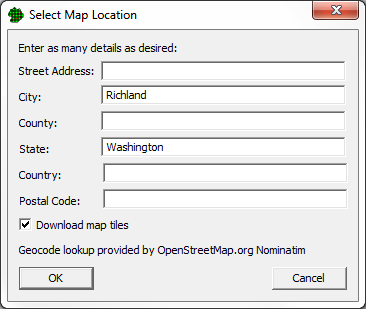
This feature is one of the easiest ways to start working on a site without having a map file to start. Simply use this dialog to type in an address or city. VSP will use a Geocoder service (OpenStreetMap.org Nominatim) to find the latitude and longitude of your location. If more than one location matches your criteria, VSP will present another dialog that allows you to choose the one you want.
If you have not already defined a projected coordinate system, VSP will ask you to choose one to display your map. (It is actually best if your coordinate system is not defined before you use this feature.) If your location is in the United States, VSP will recommend a state plane system, however you can always choose the Universal Transverse Mercator (UTM) system instead. If your location is in Great Britain, VSP will recommend the British National Grid (BNG) system, however you can always choose the UTM system instead. For other locations, VSP will recommend a UTM system.
If you leave the Download map tiles button checked, VSP will automatically begin displaying the map tiles for your location after the coordinate system is defined.