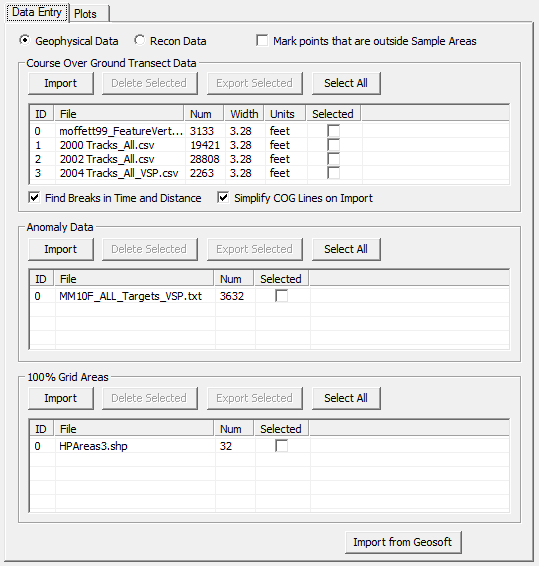
This sub-page of the UXO Data Entry / Plots page allows input and output of Course-Over-Ground (COG) Transects and Anomaly locations. These locations are needed for analyzing areas of elevated anomaly density.
This sub-page also supports the import and export of 100% Survey Grid Areas. These are areas within the study site that have had complete Geophysical characterization. Data from these 100% Grid Areas can be used to enhance the Density Mapping functionality.
Find Gaps in Time and Distance checkbox
Simplify COG Lines on Import checkbox