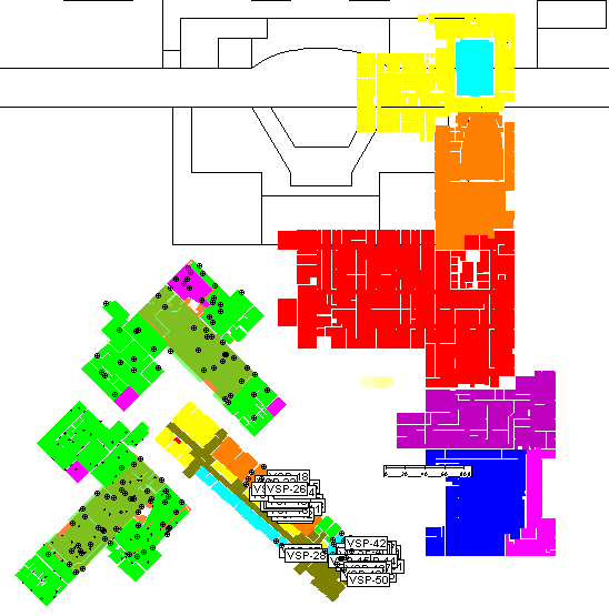
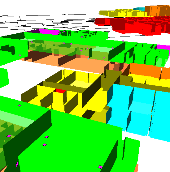
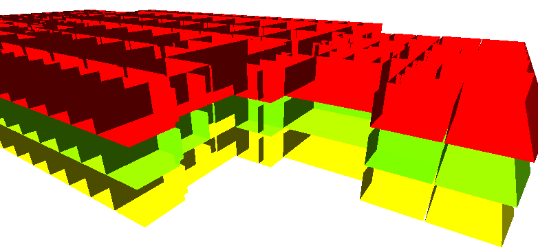
This command allows you to place onto this project map a representation (known as a Building Footprint) of the rooms / building contained in another VSP project file. This function allows this project map to act as a container of sorts for all the individual building project files in a localized area. These Footprints can be visualized on the Map View and the 3D View.
To place a Footprint on this map, choose a VSP project file that contains rooms / building information and then click on the map where you want the Footprint to be placed. The Footprint is placed with its lower-left hand corner at your insertion point. You can also enter the coordinates on the keyboard.
After placing the Footprint, it can be selected (by clicking on it on the Map) and then moved, rotated or deleted. To move, simply grab with the mouse and drag. To rotate, put the cursor over the rotate knob at the lower-left corner of the selected Footprint, hold the left mouse button and move to a new angle of orientation. To delete, just press the Del key on the keyboard. The position and angle can also be changed by editing the X Coordinate, Y Coordinate and Angle properties on the Layer Control / Properties Bar.
The Footprint also has a Z Offset property This feature allows you to keep each floor of a multi-story building in a separate VSP project file and then view them all together (located at their proper vertical position) in this VSP project map.
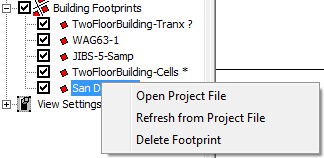
The Building Footprints section on the Layer Control bar allows you to manage the Footprints on your project map. Each Footprint is listed by file name. If the name is followed by a ? symbol, this means that the VSP project file has been moved, renamed or deleted. If the name is followed by a * symbol, this means the VSP project file has been saved since the last time the Footprint was updated in this project map. Checking the box next to the Footprint name displays or hides the Footprint on the Map View and 3D View. Right-clicking on a Footprint name provides access to a pop-up menu with these commands:
Open Project File - opens the VSP project file in VSP (if the file has been moved or renamed, you will be given the opportunity to locate the file)
Refresh from Project File - updates the Footprint based on the contents of the VSP project file (if the file has been moved or renamed, you will be given the opportunity to locate the file)
Delete Footprint - removes the Footprint from this project map (the VSP Project File pointed to by the Footprint will not be affected in any way)
The same pop-up menu is available by right-clicking on a Footprint on the Map View.
Right-clicking on the Building Footprints heading on the Layer Control bar allows you to refresh all the Footprints that are outdated.