Traditionally, a survey design completed in VSP results in parallel transects spaced at a distance necessary to traverse and detect a target area of a certain size, shape,and metallic anomaly density.
This method was developed to address survey areas with previously completed transects or for areas that are difficult to access with complete coverage of such parallel transects. For example, a site has existing meandering path survey transects but is densely forested in the unsampled area.
This design allows the user to ask the question, "Is the spacing and pattern of these existing paths sufficient to provide the necessary coverage to traverse and detect the target area of concern, or are additional transects needed?" This document describes the process used to find the areas ("gap areas") where additional transects are needed.
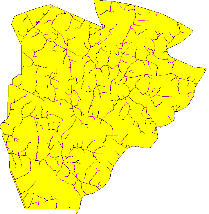
The general methodology consists of 2 parts: 1) finding gaps in the existing path network and 2) placing transects on those gaps. Below is an example site that contains surveys along existing roads and paths:

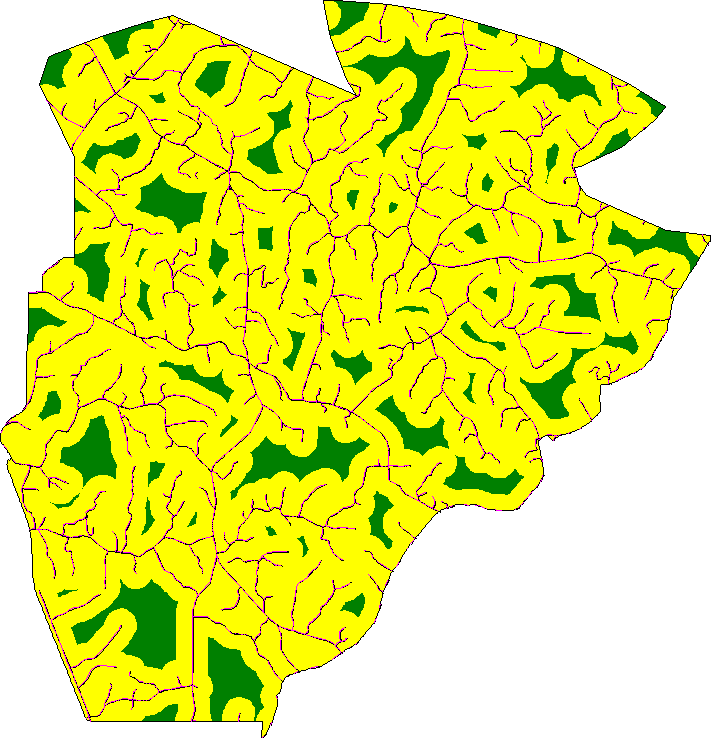
A buffer is placed around all of the existing trails, roads and paths. This buffer represents the radius of a target area that would be traversed by an existing path. The following figure shows the gaps that are left by putting a 1000-foot buffer around the existing paths. Details of the methodology used to find the gap areas are documented in Methodology for Defining Gap Areas between Course-over-ground Locations (Wilson, 2013, PNNL-22851).

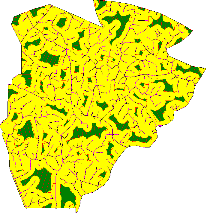
New transects are placed in order to traverse potential target areas that would have been missed by existing transect paths. Parallel transects are placed in gap areas while trying to minimize the total length of the transect. You can choose the option of having transects connected together into long continuous paths. Another option is to have the new transect paths attached to existing paths. Details of the methodology used to place transects in the gap areas are documented in Methodology for Augmenting Existing Paths with Additional Parallel Transects (Wilson, 2013, PNNL-22770). The following figure illustrates parallel transects placed on the gaps, connected together and attached to existing paths:

Wilson JE. 2013. Methodology for Defining Gap Areas between Course-over-ground Locations. PNNL-22851, Pacific Northwest National Laboratory, Richland, WA. http://www.pnl.gov/main/publications/external/technical_reports/PNNL-22851.pdf
Wilson JE. 2013. Methodology for Augmenting Existing Paths with Additional Parallel Transects. PNNL-22770, Pacific Northwest National Laboratory, Richland, WA. http://www.pnl.gov/main/publications/external/technical_reports/PNNL-22770.pdf
See the UXO Transect Spacing Design for details on the Survey & Target Area Pattern page and the Transect Spacing page. Note that this design only allows parallel transects and circular target areas.
Gaps and New Transects page
Buffer around previous transects
Course Over Ground Data - see the UXO Data Entry sub-page for details on this section